Pilot Guide
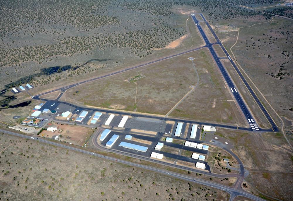
The Prineville Airport is located three miles SW of the city at 44° 17’ 16”N, 120° 54’ 18.6”W. Prineville has two well-maintained intersecting asphalt runways. Runway 11/29 is our main runway at 5405’ x 75’, with MIRL and PAPI lights for runway 29 controlled using CTAF. Crosswind runway is 15/33 at 4054’ x 40’ with LIRL also controlled using CTAF 122.7.
The terminal is open 7 days a week, Mon-Fri: 8am-4:30pm, Sat-Sun: 9am-2pm. After-hours access to restrooms, snacks, and planning room with free WIFI and computers are available through the side door access. The code for door access is available through the use of self-serve fuel pumps.

Airport Information
FAA Identifier: S39
Lat/Long: 44-17-16.0000N / 120-54-18.6000W
44-17.266667N / 120-54.310000W
Elevation: 3251.3 ft. / 991 m (estimated)
Variation: 18E
From City: 3 miles SW of Prineville, OR.
Time Zone: UTC -7 (-8 during standard time)
Zip Code: 97754
Sectional Chart: KLAMATH FALLS
AWOS: 118.325 (541)447-4060
CTAF: 122.7
*Beginning 3/26/20 (FAA publish date), the Prineville Airport (S39) CTAF changed to 122.7
Runway Information:
11/29- 5405’ x 75 MIRL, PAPI Runway 29,
15/33- 4054’ x 40’ LIRL
Pilot Controlled Lighting using CTAF
Services:
- Fuel (Jet-A & 100LL)
- Parking (tie downs)
- Lounge and limited-use courtesy car
- Two on-field maintenance facilities with flight instruction
24 Hr. Services:
- Planning room
- Vending machines
- Free WIFI
- Bathrooms (with shower in ladies room)